6.95° West of Greenwich and 55.05° North of the equator
|
A Map of the Area
6.95° West of Greenwich and 55.05° North of the equator
|
|
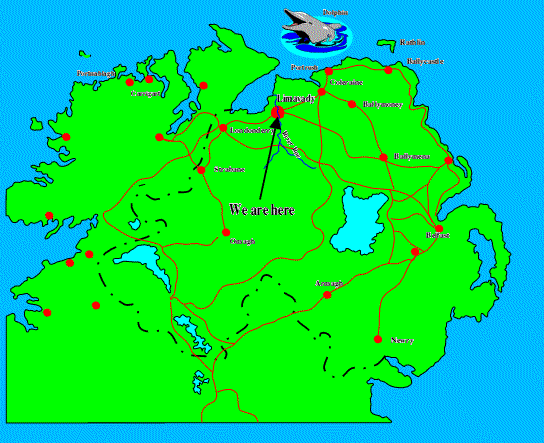
You are looking at a map of Northern Ireland.
As you can see, Limavady is not far away from Loch Foyle and the Atlantic Ocean. The town is surrounded by green countryside, although the map overdoes this aspect of the place. The "City of Derry Airport" in Eglinton airport is quite close. The River Roe flows past the town and the foothills of the Sperrin mountains enclose it. Benevenagh mountain dominates the view from a distance and the weather tends to be on the wet side.
|
